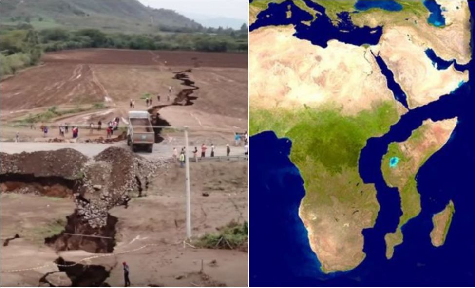
A series of slowly widening fissures in southern Ethiopia once again drew the attention of scientists and authorities to one of the most significant geological processes on the planet: the progressive opening of the African Rift Valley. The phenomenon, which occurs over thousands to millions of years, could in the future divide the African continent into two large landmasses.
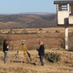
In rural areas of the Afar region in eastern Ethiopia, irregular cracks already cut the ground, crossing pastures, roads and agricultural areas. In some points, the land has a sulfur odor and constant crackling noises, the result of volcanic activity associated with the stretching of the Earth’s crust. Residents report that previously passable places are now interrupted by deep cracks, while scientific teams monitor the evolution of the process with satellite images and field measuring instruments.
The African Rift Valley is a gigantic zone of tectonic fractures that stretches for more than 6 thousand kilometers, from the Red Sea to Mozambique. In this region, tectonic plates are gradually moving apart, at a movement of a few millimeters per year. Although imperceptible in everyday life, this continuous separation causes fractures on the surface and favors the rise of magma from the Earth’s interior, forming new crust as the material solidifies.
The episode that put the phenomenon in the spotlight occurred in 2005, when a large rift suddenly opened in the Afar desert. Within days, an abyss emerged dozens of kilometers long and wide enough to cut off highways. Satellite images recorded the event as a rare example, on dry land, of a common process at the bottom of the oceans, where new tectonic plates continually form.
Since then, researchers have observed the emergence of smaller fissures in different parts of Ethiopia, Kenya and neighboring countries. In some locations, roads were damaged, irrigation systems broke and communities had to adapt routines in the face of soil instability. Local authorities are monitoring the situation, although they recognize that there are no measures capable of interrupting a geological process on this scale.
For the scientific community, the African Rift Valley functions as a natural laboratory. The study of fractures allows us to better understand how continents form and fragment over time. According to geologists, if the current movement continues, ocean water could invade the lowered area, giving rise to a new maritime arm and, eventually, a new ocean. This scenario, however, is only projected to occur in millions of years.
Despite the distant horizon, the immediate impacts worry local populations. Farmers and pastoralists report losses of productive land and difficulties in traveling. In more isolated regions, the sudden opening of fissures poses a direct risk to safety, especially during periods of rain, when the soil becomes more unstable. Regional governments and international organizations have invested in geological mapping to identify areas of greatest risk.
International interest also grew with the circulation of videos and images on social media, showing the ground “opening up” in real time. Experts warn, however, that the phenomenon should not be interpreted as an imminent catastrophic event, but as part of a slow and continuous process. “This is not a sudden rupture of the continent, but rather a progressive stretching of the crust”, explain researchers involved in monitoring the region.
In addition to the scientific aspect, the African Rift Valley has historical and environmental relevance. The region is home to important archaeological sites linked to human evolution and unique ecosystems, adapted to extreme geological and climatic conditions. Tectonic activity influences the formation of lakes, the fertility of volcanic soil and the availability of natural resources, factors that have shaped human occupation over millennia.
Experts highlight that continuous monitoring of the phenomenon is essential to reduce risks and guide public policies. Alert systems, infrastructure planning and education of local communities are highlighted as fundamental measures to deal with the most immediate effects of fractures.
While scientists observe and record each new fissure, the East African landscape continues to silently transform. What today manifests itself as cracks in dirt roads and pasture fields could, in a distant geological future, redraw the map of the planet, creating new seas and definitively altering the configuration of Africa.
Source: https://www.ocafezinho.com/2026/01/15/grandes-rachaduras-no-solo-da-etiopia-revelam-processo-geologico-que-pode-dividir-a-africa-e-formar-novo-oceano/